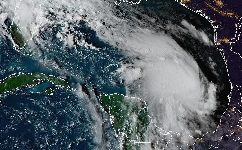
Tropical Storm Isaias emerged early Wednesday in the warm waters off eastern Mexico, sparking concerns across the U.S. Gulf Coast. Forecasters believe the system will likely intensify into the first hurricane of the Atlantic season before making landfall later this week. Currently centered several hundred miles west of Progreso, Mexico, the storm is drifting east northeast with maximum sustained winds reaching 40 mph.
While its exact point of impact remains uncertain, meteorologists suggest Isaias could move onshore late Friday or early Saturday. The current projected path places the center of the storm somewhere between eastern Louisiana and the western Florida Panhandle. Officials warn that residents in these regions face an increasing risk of dangerous wind speeds and significant storm surges as the system gains strength.
In response to the threat, Florida Governor Ron DeSantis has already declared a state of emergency for 25 counties spanning the Big Bend and Panhandle regions. This move activates state emergency management plans, allowing officials to deploy critical personnel and equipment ahead of time to mitigate potential disaster damage. Residents throughout the northern Gulf are being urged to review their evacuation plans and stay tuned to local weather updates.
Beyond coastal flooding and wind, Isaias is expected to dump heavy rainfall across much of the U.S. Southeast heading into the weekend. The arrival of this storm follows an unusually dormant start to the Atlantic hurricane season, which experts attribute to a strong El Niño pattern that typically suppresses storm formation in this region while boosting activity in the Pacific.